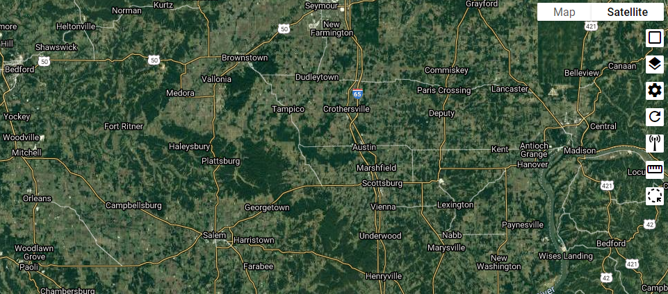
Map Layers
Map Layers allow you to filter data on your homepage map, as well as subscriber maps.
Modifying the Map Layers can be useful if you want to see items data like where your towers are located, subscriber locations, service area locations and more.
Toggle Layers
Click the card stack 
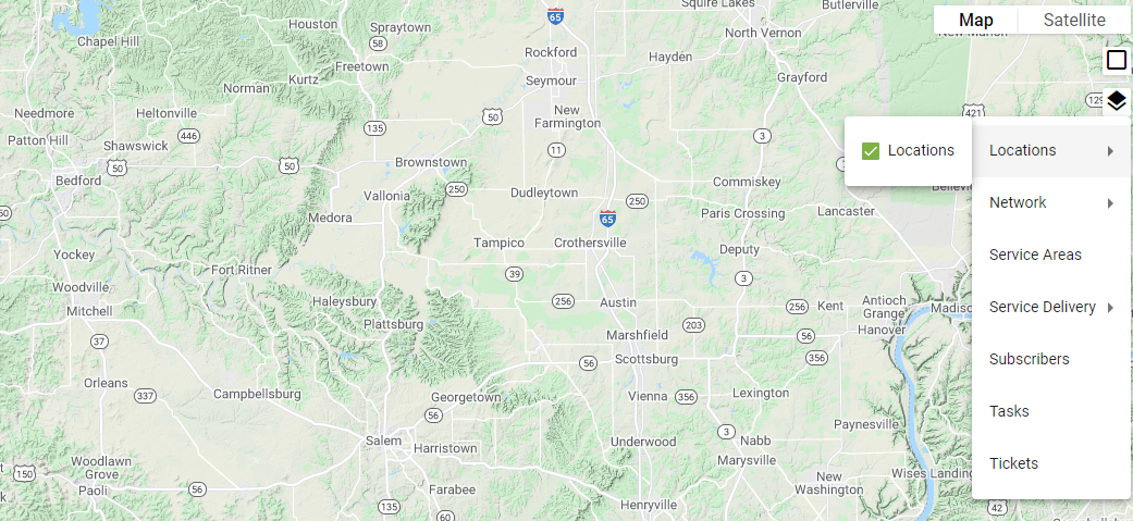
Click on an option under toggle layers to view more details about the display options.
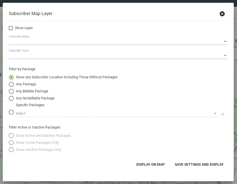
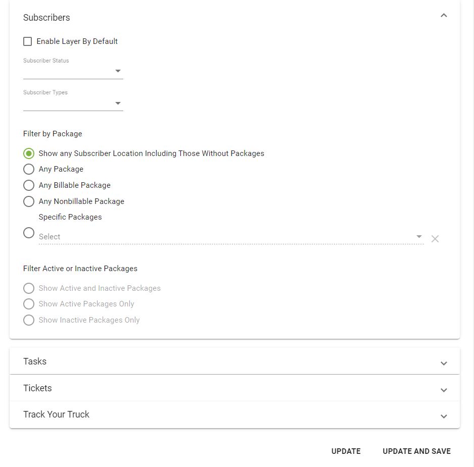
Subscriber Map Layer is a helpful tool to use to view Subscriber data visually. Choose a Subscriber status (current, delinquent, etc.) and type (residential, business, etc.) from the dropdown menu.
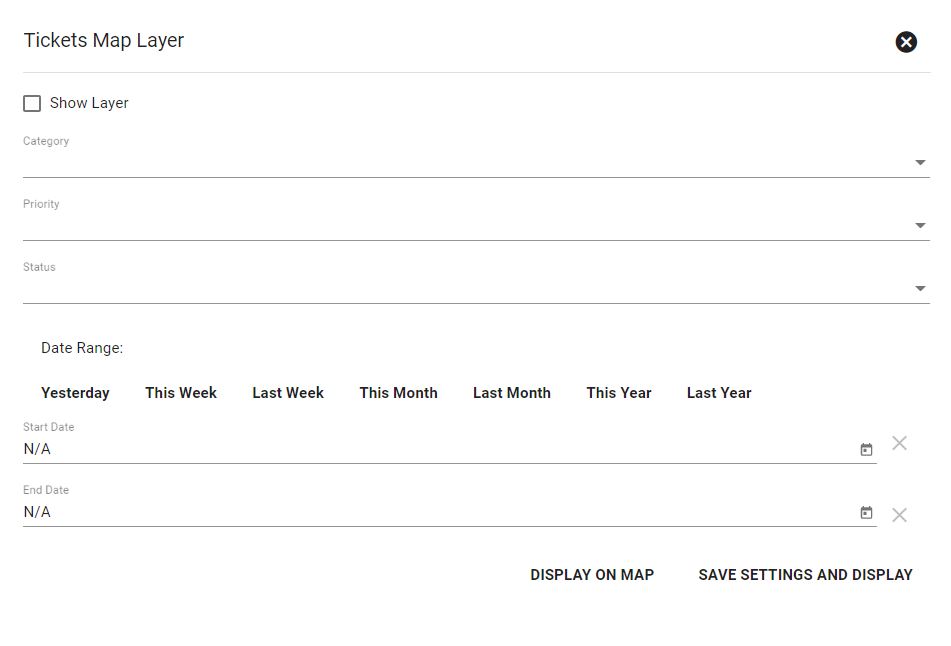
Be sure to select SHOW LAYER to display the data on the map.
Select DISPLAY ON MAP or SAVE SETTINGS AND DISPLAY to save changes.
DISPLAY ON MAP will save the layer settings to be displayed on a single map, while SAVE SETTINGS AND DISPLAY will apply the layer settings to all maps.
Displaying Tickets, Tasks, Calendar or Network Events will prompt you to select a date range of data to display. Selecting THIS WEEK will display live data and consistently refresh to display new Tickets, Tasks, Calendar or Network Events.
Click DISPLAY ON MAP or SAVE SETTINGS AND DISPLAY to save your changes.
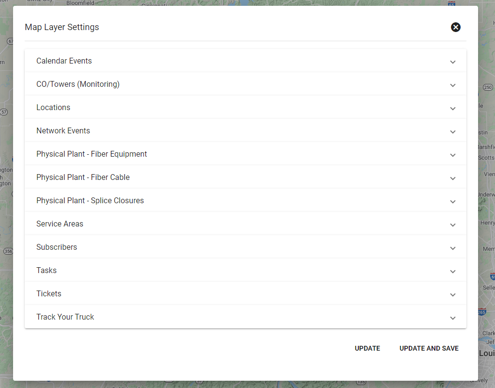
Layer Settings
Click on 
Layer settings provides additional filters to supplement toggle layers.
For example, the Subscriber layer setting allows you to choose whether to always enable this layer when dispaying a map (ENABLE LAYER BY DEFAULT).
Select UPDATE (to make layer changes temporary) or UPDATE AND SAVE (to view these layers each time you access the base map) when finished.
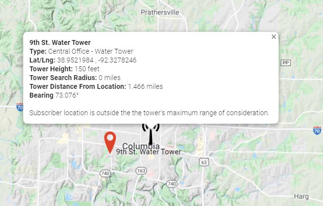
Line of Sight Tool
The Line of Sight tool 
Click Search Address to display a specific address on the map. Click and drag the pin if needed place it more precisely on a building.
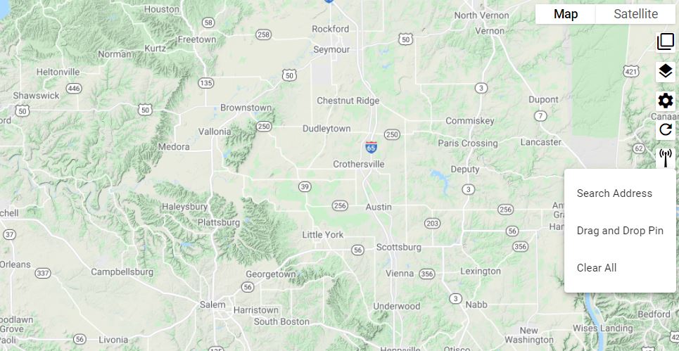
Select Drag and Drop Pin to move a pin to a specific location. Drag and drop a pin onto a rooftop to learn the address, or use it to identify if an area would be in range of a tower or CO.
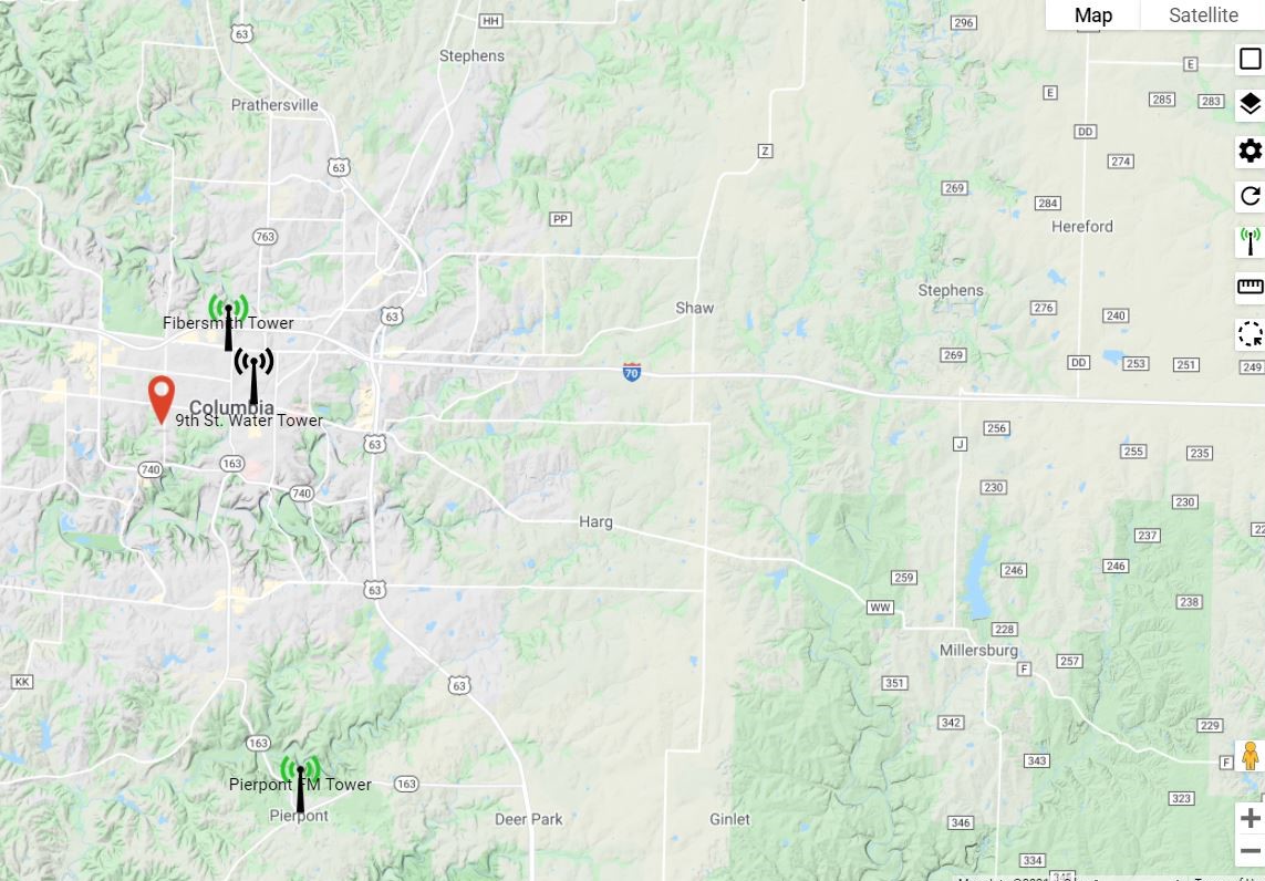
Click on a specific tower to view the tower details, or to view if a specific Subscriber address is in range of a tower.
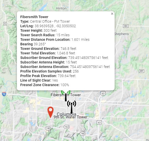
A tower will display with green bars to indicate that it is in range of an address, yellow bars if the address is partially in range or red bars if it is not in range.
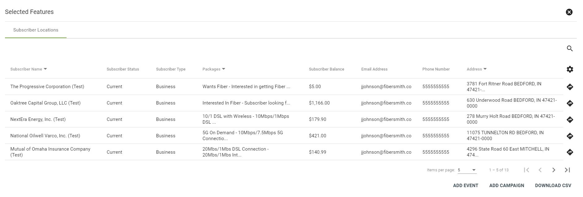
Select Data Objects
The Select Data Objects icon ![]()
Click on a line item to view the Subscriber's profile.
Select ADD EVENT to add a Network Event for the selected Subscribers, or ADD CAMPAIGN to send a marketing campaign to the selected Subscribers.