BDC Reporting
Regulatory - BDC Reporting
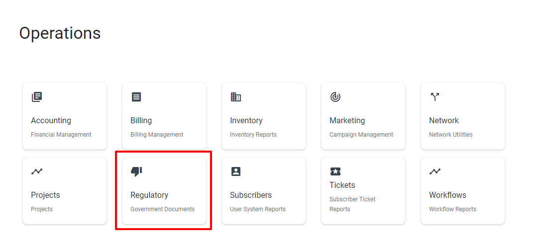
To navigate your way to Broadband Data Collection reporting to see; Submissions, Fabric Releases, Mapping, and Polygons, first click the Main Menu 

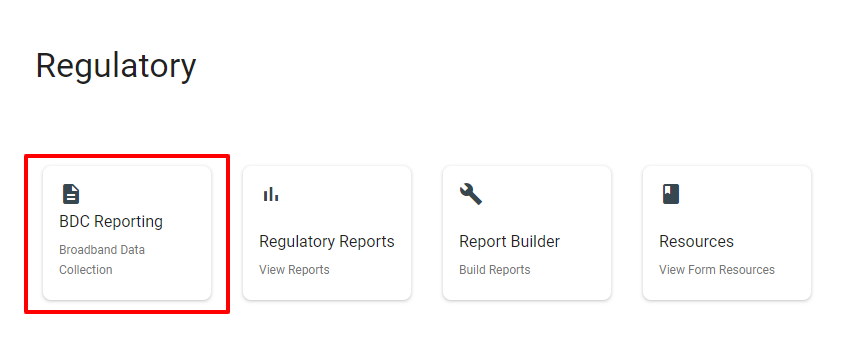
![]() section, in the Regulatory section there will be a section called BDC Reporting that holds all the information regarding your BDC data.
section, in the Regulatory section there will be a section called BDC Reporting that holds all the information regarding your BDC data.
Quick Links:
What you need to get started:
- Provider ID Number
- FCC Registration Number (FRN)
- The Latest Fabric Release
- BDC Status and Types setup
(If these are not already set up, follow the BDC Setup Guide to complete this step.)
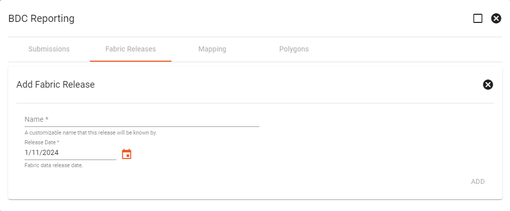
Adding Fabric Release:
The fabric releases are datasets from the FCC of all the locations in the United States that display where fixed broadband services are available or unavailable at the time of the release. These datasets are released every 6 months and will need to be updated in Vision when a new release is distributed.
To add a Fabric Release the floating action button ![]() in the lower right corner will direct you to add a customizable name for the fabric release to be known by and the release date of the fabric data.
in the lower right corner will direct you to add a customizable name for the fabric release to be known by and the release date of the fabric data.
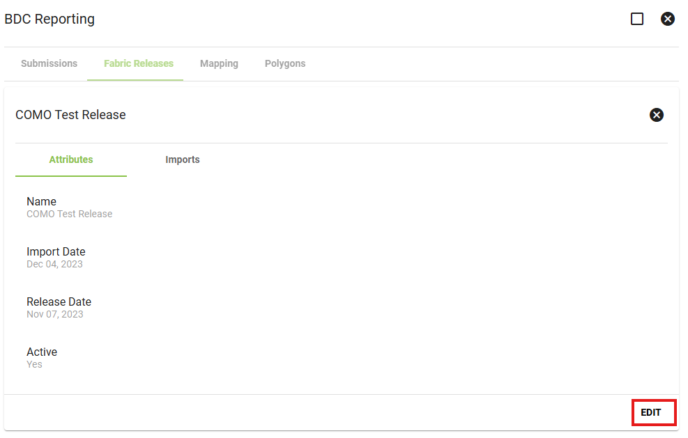
The attributes of the Fabric releases can be found after clicking on a specific release. This will also be the place to find which data files were used for the import to give an understanding of the information that was imported.
To import data into the fabric release, click into the Fabric Release, click 'edit', and go to the imports tab.
Here you can upload your fabric location data and manage all of your uploads. For each release, you have to add 3 files: a BSL, NOBSL, and supplementary data. These files are all provided by the FCC.
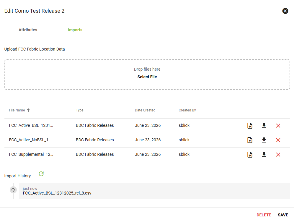
Once uploaded, they must be imported into Vision. To do this, click on the file icon on the files you just uploaded.
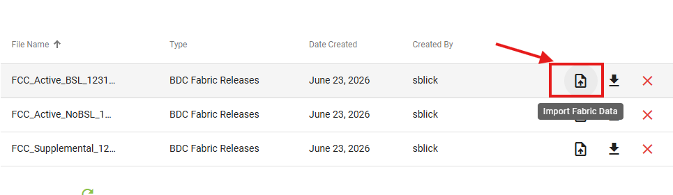
Then select what type of data it is.
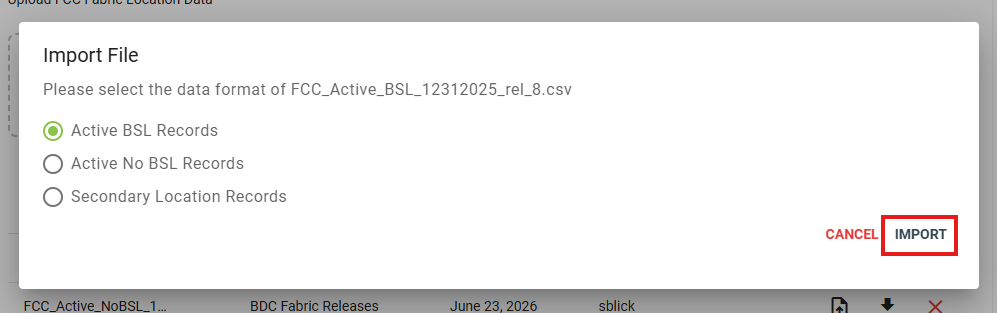
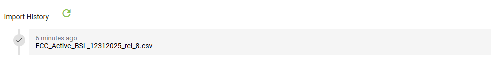
This will then be imported into Vision with the status of its import visible below in the Import History section.
Adding a New Submission:
The reason we want to add new submissions is to keep a record of previously filed reports. That is why we recommend setting up at least a "Completed" and "In-Progress" BDC status. To start a new submission process click the FAB ![]() while on the submissions tab and it will prompt you to provide information for the new submission.
while on the submissions tab and it will prompt you to provide information for the new submission.
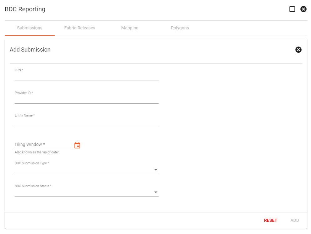
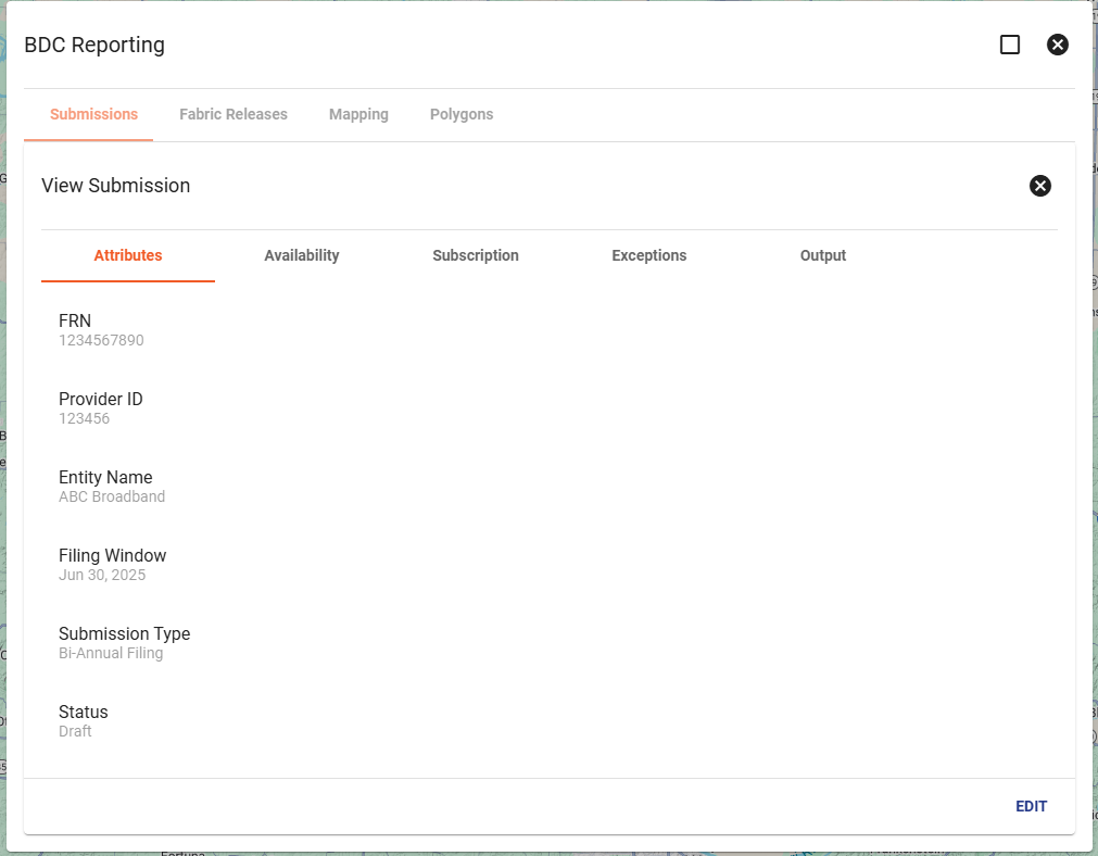
This creates a new row under the submissions tab where it will store information for this BDC Report. Clicking on any row will bring up the submission and its available reports.
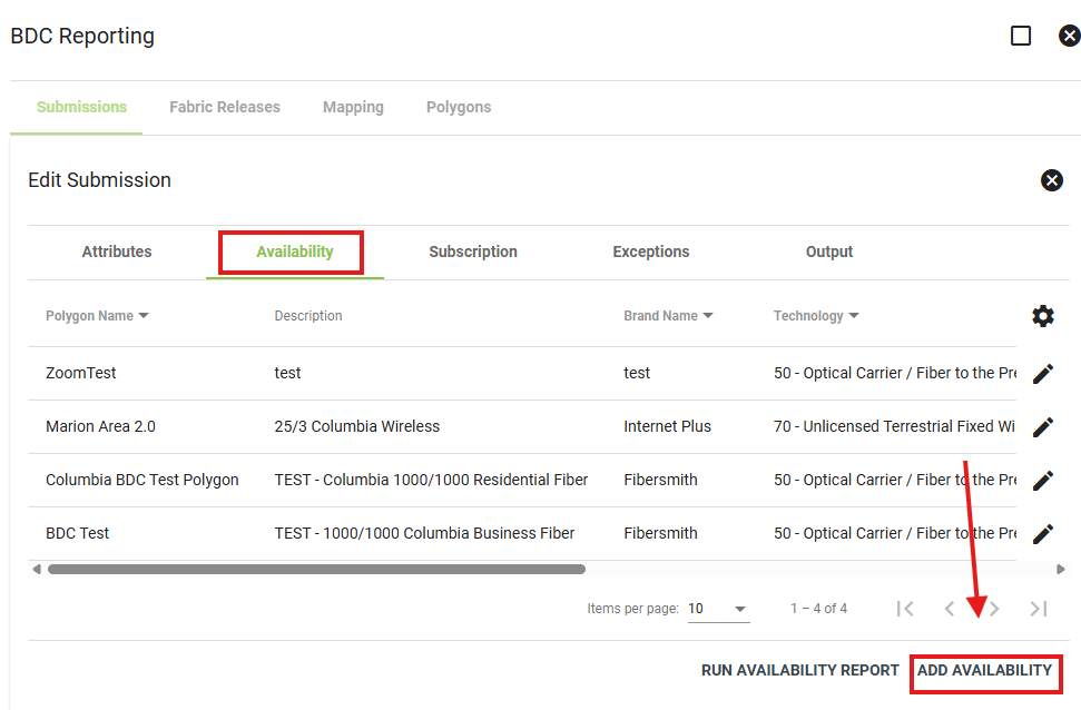
Creating Your Availability Report:
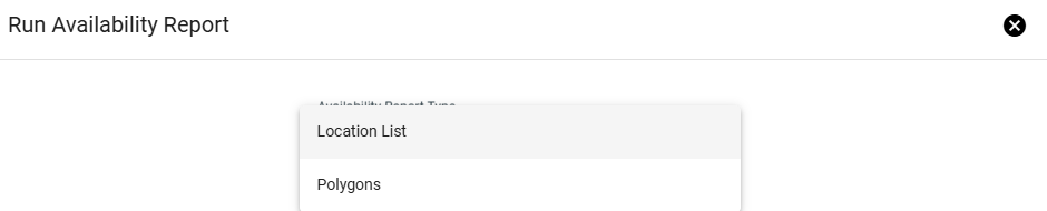
When submitting availability information to the BDC, you can submit your data in one of two formats: a Location List CSV or a Polygon GeoJSON.
The report type you use will depend on how you wish to submit your availability data. A Location List Report provides a CSV file of eligible locations, while a Polygon Report provides a GeoJSON file of the availability areas added to the submission.
To download either report after it has been generated, open the appropriate submission and navigate to the Output tab. Locate the row for the report you need, then click the download option.
Location List Report
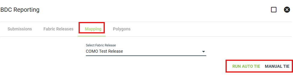
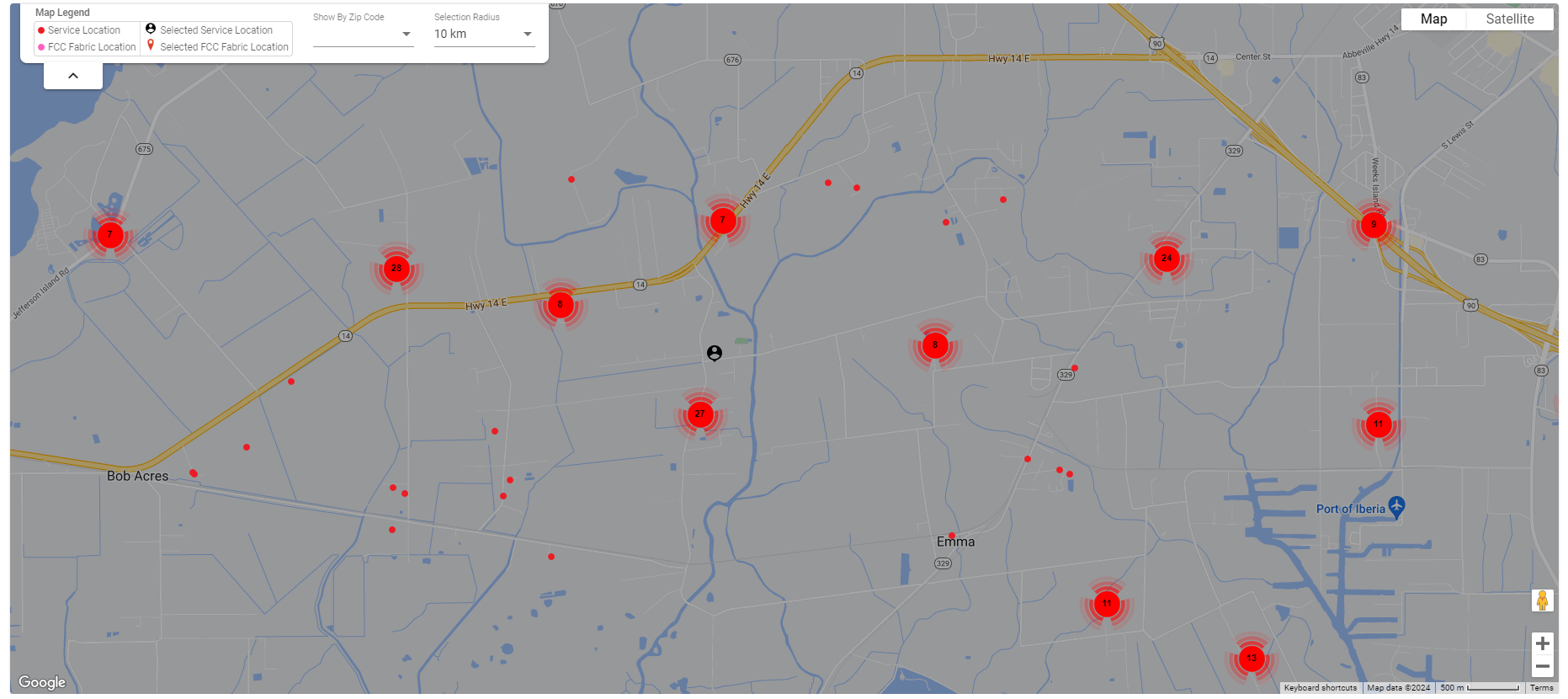
A Location List Report generates a CSV file of Vision service locations that have been matched to FCC Fabric locations. Before running this report, your service locations must be connected to their corresponding FCC Fabric locations in the Mapping tab.
By default, Vision locations are not automatically matched to Fabric data. To create these matches, you must first upload and import the fabric data into the Fabric Release. Then, under the Mapping section of BDC Reporting, you can review the service locations and match them to the appropriate FCC Fabric locations using either Auto Tie or Manual Tie.
Running Auto Tie or manually matching locations is a prerequisite for the Location List Report. When the report is generated, Vision reviews the service locations and includes the locations that have a valid match to an FCC Fabric location.
Manual Tie Page:
To generate the report, open your latest in-progress submission and click Edit. From the Availability tab, select Run Availability Report.
In the report dialog, choose the report type, select the fabric release, and enter the As-Is Date. You can also choose to email yourself the completed report, since generation may take a minute.
Once complete, the Location List Report will be available as a CSV file in the submission’s Output tab.
Polygon Report
The Polygon Report creates a GeoJSON file using the availability polygons added to the submission. This report is used for polygon-based BDC submissions.
Before generating the Polygon Report, you must add the availability areas that should be included in the submission. To do this, open the Availability tab and click Add Availability.
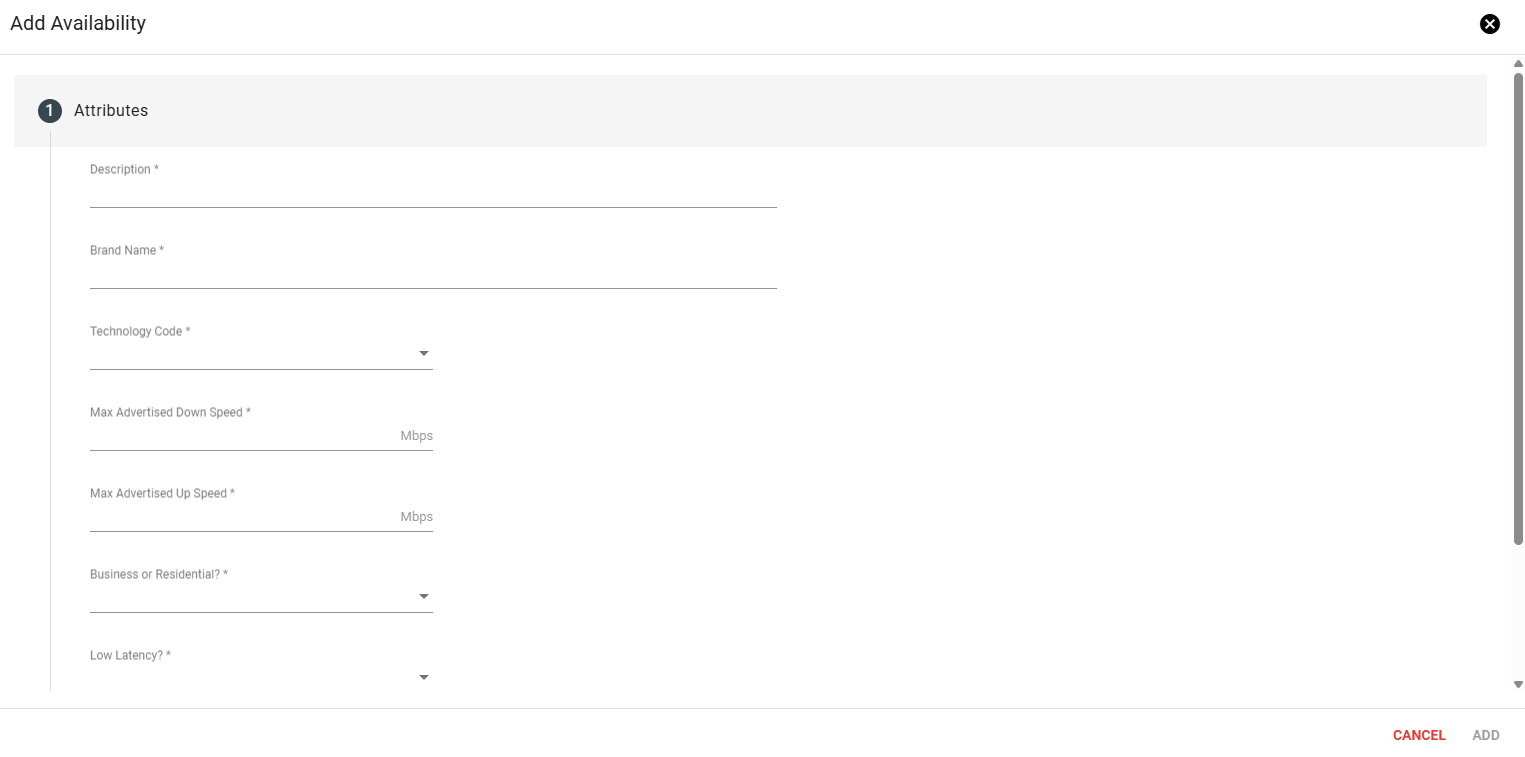
Complete the availability form with the required service details, including the available technology type, advertised speeds, and any other applicable service information. Then, select the polygon that represents the availability area. You can choose an existing polygon or create a new one.
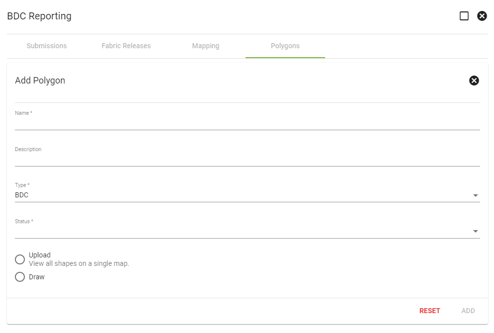
Polygons can be managed from the Polygons tab. This section allows you to create, name, label, and update service area polygons based on their type and status. These polygons represent drawn service areas and can be adjusted as your service area changes or as additional locations are added.
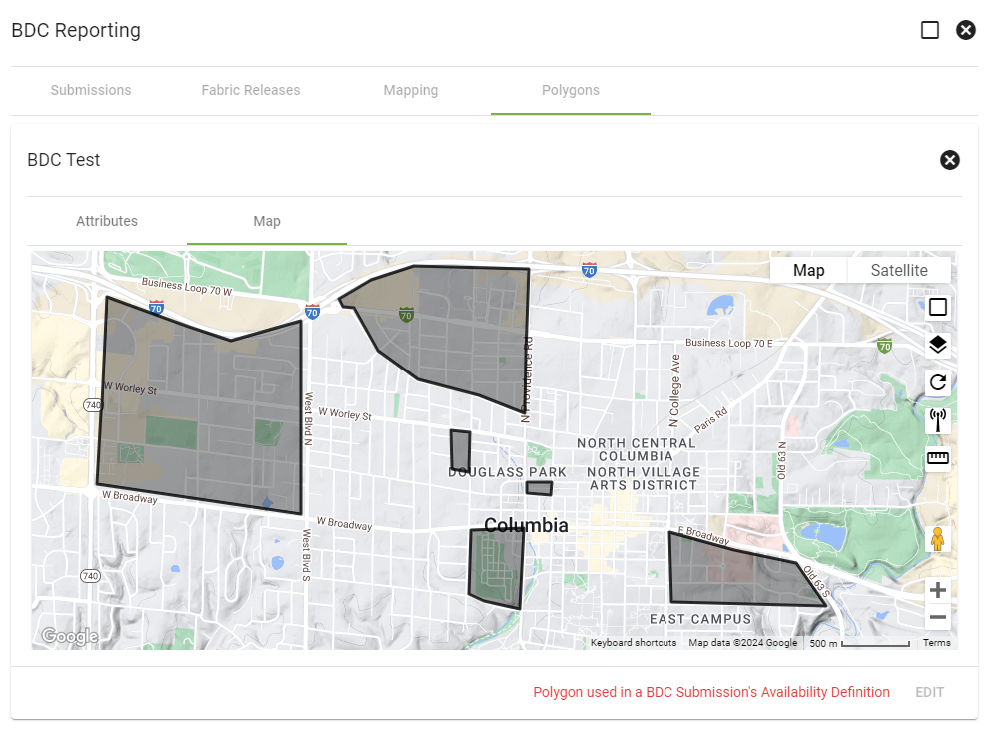
To add a polygon, click the floating action button in the lower-right corner of the Polygons tab. From there, enter the polygon name and status. You can either upload an existing service area polygon or draw the shape directly on the map.
Once the polygons have been added and assigned to the correct availability areas, the completed Polygon Report can be downloaded as a GeoJSON file from the submission’s Output tab.
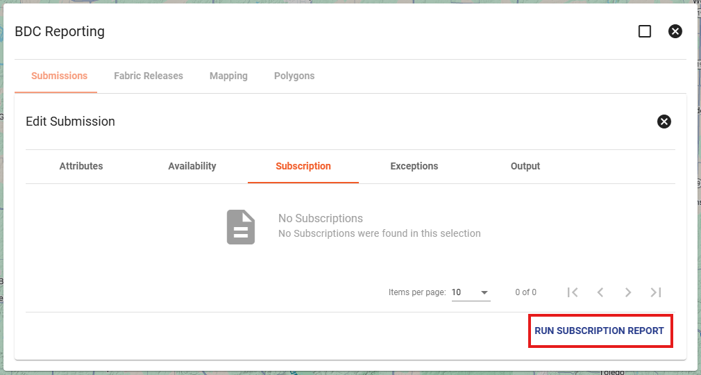
Creating Your Subscription Report:
To get your Subscription report go to your latest in-progress submission and click "Edit". You can then navigate to the "Subscription" tab and the option for "Run Subscription Report" will be available.
Clicking this reveals a dialog where you can input the report type and the As-Of date. You also have the option to email yourself the report once it is finished as this step could take a minute.
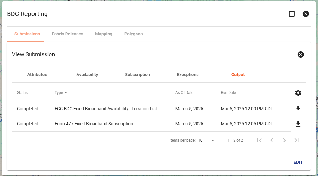
To access the download of this report, select the appropriate submission and navigate to the "Output" tab and look for the "Form 477 Fixed Broadband Subscription" row and download.
Accessing Your Reports:
You can download the CSVs that a report generates from the "Output" tab from any of the submission reports you have generated.
Best Practice: Keeping Submissions Organized
To maintain clear records, we recommend keeping making multiple submissions as to not override your previous ones, the best way to manage these submissions is using their Status field:
- While preparing reports, keep the status as In-Progress.
- Once filed, change the status to Submitted or Completed — whichever fits your internal naming convention.
You can update a submission’s status at any time by:
- Clicking Edit on the submission.
- Changing the Status field.